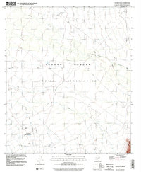
1996 Map of Chukut Kuk
USGS Topo · Published 2002About this map
The Tohono O'odham Indian Reservation landscape is defined by its seasonal drainages and high desert valleys as they appeared in the late 1990s. The settlement of Chukut Kuk sits near the head of the Chukut Kuk Wash, positioned where the basin begins to drain southward. To the east, the Tecolote Ranch and a nearby Cemetery provide evidence of localized habitation in the Tecolote Valley.
Find a feature on this map
14 named features on this map. Tap any name to fly to it.
Don’t see what you’re looking for? This feature index may not catch every label — zoom into the map to look around manually.
Map Details
Editions of this 1996 Chukut Kuk Map
This is the sole edition of this map. No revisions or reprints were ever made.
Other maps of this area

1941 · Vamori
USGS Topo · 1:62,500

1941 · Sells
USGS Topo · 1:62,500

1943 · Sells
USGS Topo · 1:62,500

1943 · Fresnal
USGS Topo · 1:125,000

1943 · Vamori
USGS Topo · 1:62,500

1954 · Sonoyta
USGS Topo · 1:250,000

1956 · Nogales
USGS Topo · 1:250,000

1958 · Nogales
USGS Topo · 1:250,000

1959 · Nogales
USGS Topo · 1:250,000

1963 · Gu Oidak
USGS Topo · 1:62,500