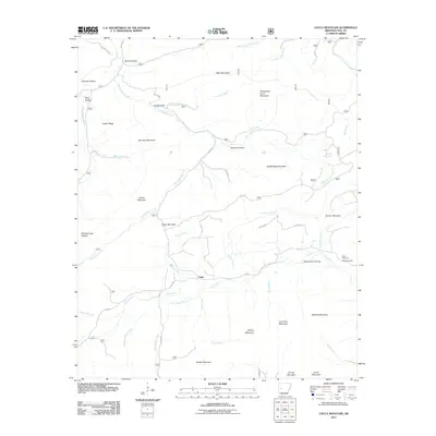
2011 Map of Chula Mountain
USGS Topo · Published 2011About this map
Chula serves as the central settlement in this upland region of Yell County, situated where Irons Fork meets Glover Creek and Clark Creek. The landscape is defined by a series of prominent ridges and family-named landmarks, including Bee Suck Mountain, Hoover Mountain, and Qualls Mountain. To the north, the terrain drops from Main Mountain into drainages like Right Prong Bear Creek and Left Prong Bear Creek, while the southern reaches are dominated by Muddy Mountain and Brushy Mountain. Local history and genealogy researchers will find several significant sites, notably Killian Cemetery and Chula Cemetery located east of the main settlement near Peter Green Hollow. The map also details numerous forestry and county routes such as County Rd 853 and Bluff Rd, which provide access to remote areas like Johnson Hollow and Chicken Hollow.
Find a feature on this map
54 named features on this map. Tap any name to fly to it.
Don’t see what you’re looking for? This feature index may not catch every label — zoom into the map to look around manually.
Map Details
Editions of this 2011 Chula Mountain Map
This is the sole edition of this map. No revisions or reprints were ever made.
Other maps of this area

1890 · Mount Ida
USGS Topo · 1:125,000

1890 · Hot Springs
USGS Topo · 1:125,000

1894 · Hot Springs
USGS Topo · 1:125,000

1955 · Little Rock
USGS Topo · 1:250,000

1956 · Little Rock
USGS Topo · 1:250,000

1959 · Mount Ida
USGS Topo · 1:62,500

1960 · Little Rock
USGS Topo · 1:250,000

1960 · Gravelly
USGS Topo · 1:62,500

1962 · Fannie
USGS Topo · 1:24,000

1964 · Little Rock
USGS Topo · 1:250,000