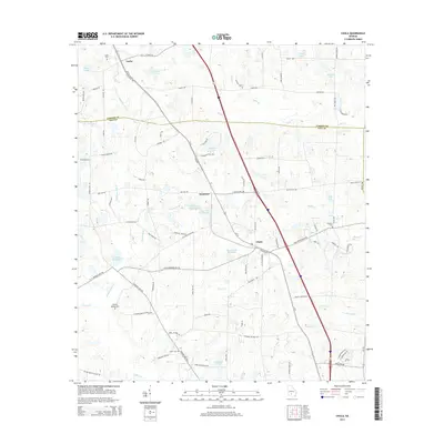
2014 Map of Chula
USGS Topo · Published 2014About this map
Chula serves as a central hub in this landscape where agriculture and water management define the local geography. The map illustrates a network of family-named landmarks and water features, such as Whiddons Millpond and Derris Lake Number 1, which speak to the historic reliance on local hydrology for milling and irrigation. The settlement pattern is anchored by small communities like Inaha and Sunsweet, connected by a grid of rural roads and the prominent corridor of Us-41. For genealogists, the inclusion of several burial sites, including Inaha Cem, Fletcher Cem, and Hickory Springs Cem, provides precise locations for family history research. The boundary between Turner Co and Tift Co cuts across the northern section, highlighting the administrative divisions of this South Georgia region.
Find a feature on this map
96 named features on this map. Tap any name to fly to it.
Don’t see what you’re looking for? This feature index may not catch every label — zoom into the map to look around manually.
Map Details
Editions of this 2014 Chula Map
This is the sole edition of this map. No revisions or reprints were ever made.
Other maps of this area

1953 · Waycross
USGS Topo · 1:250,000

1958 · Waycross
USGS Topo · 1:250,000

1973 · Sumner
USGS Topo · 1:24,000

1973 · Ty Ty
USGS Topo · 1:24,000

1973 · Waterloo
USGS Topo · 1:24,000

1973 · Irwinville
USGS Topo · 1:24,000

1973 · Ashburn
USGS Topo · 1:24,000

1973 · Chula
USGS Topo · 1:24,000

1973 · Tifton East
USGS Topo · 1:24,000

1973 · Tifton West
USGS Topo · 1:24,000