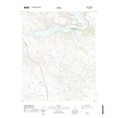
2019 Map of Chunky
USGS Topo · Published 2019About this map
Lake Meredith National Recreation Area dominates the northern reaches of this Texas Panhandle landscape, where the Canadian River is fed by a complex network of draws and creeks. The terrain is defined by dramatic erosion, notably at Saddle Horse Canyon and the winding course of Rosita Creek. The small settlement of Chunky sits in the southwestern portion of the sheet, connected by a network of local roads including Park Cir N and River Park Dr. Natural water sources are scattered throughout the draws, including Tincup Spring, Bog Spring, and Bullfrog Spring, illustrating the vital role of these landmarks in a semi-arid environment. The mapping highlights the contrast between the organized residential layout of Chunky and the expansive, water-carved topography of the Canadian River valley.
Find a feature on this map
22 named features on this map. Tap any name to fly to it.
Don’t see what you’re looking for? This feature index may not catch every label — zoom into the map to look around manually.
Map Details
Editions of this 2019 Chunky Map
This is the sole edition of this map. No revisions or reprints were ever made.
Other maps of this area

1934 · Cliffside
USGS Topo · 1:62,500

1936 · Fourways
USGS Topo · 1:62,500

1936 · Cliffside
USGS Topo · 1:62,500

1939 · Sanford
USGS Topo · 1:62,500

1953 · Chunky
USGS Topo · 1:24,000

1953 · Marsh
USGS Topo · 1:24,000

1953 · Puente
USGS Topo · 1:24,000

1953 · Alibates Ranch
USGS Topo · 1:24,000

1953 · Pleasant Valley
USGS Topo · 1:24,000

1953 · Mayer
USGS Topo · 1:24,000