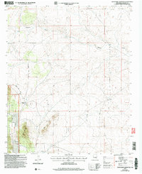
2004 Map of Chupadero Mountain
USGS Topo · Published 2006About this map
Chupadero Mountain and the Bald Hills anchor this high-elevation landscape within the Lincoln National Forest, as documented in this early 21st-century USDA Forest Service revision. The map details a mix of ranching and early resource extraction, centered around the Gnatkowski Ranch and a remote Prospect site. The topography is defined by the winding course of Hasperos Canyon, which cuts through the northern half of the quadrangle.
Find a feature on this map
16 named features on this map. Tap any name to fly to it.
Don’t see what you’re looking for? This feature index may not catch every label — zoom into the map to look around manually.
Map Details
Editions of this 2004 Chupadero Mountain Map
This is the sole edition of this map. No revisions or reprints were ever made.
Other maps of this area

1954 · Fort Sumner
USGS Topo · 1:250,000

1955 · Roswell
USGS Topo · 1:250,000

1958 · Fort Sumner
USGS Topo · 1:250,000

1958 · Roswell
USGS Topo · 1:250,000

1962 · Roswell
USGS Topo · 1:250,000

1973 · Ancho
USGS Topo · 1:24,000

1973 · Chupadero Mountain
USGS Topo · 1:24,000
1973 · White Oaks North
USGS Topo · 1:24,000

1973 · Jicarilla Peak
USGS Topo · 1:24,000

1980 · Corona
USGS Topo · 1:100,000