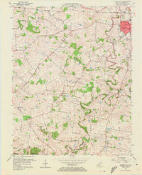
1956 Map of Church Hill
USGS Topo · Published 1972About this map
The agrarian landscape of Christian County is captured here in the mid-1950s, defined by the winding course of the Little River and its numerous tributaries. Small rural communities like Church Hill and Merrittstown dot the countryside, while the northwestern outskirts of Hopkinsville appear in the northeast corner, featuring the Radio Tower (WKOA) and the local sewage disposal plant. The area is heavily marked by local social centers, including numerous country churches such as South Union Ch and McClain Chapel. Transportation and topography are closely linked, with the Illinois Central railroad and the Jefferson Davis Highway cutting through the terrain. A notable geographic feature is the presence of sinkholes and ponds, including Buck Pond and Swallow Spring Pond, which suggest the underlying karst geology characteristic of this part of Kentucky.
Find a feature on this map
30 named features on this map. Tap any name to fly to it.
Don’t see what you’re looking for? This feature index may not catch every label — zoom into the map to look around manually.
Map Details
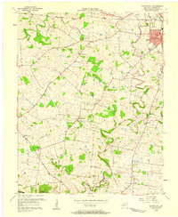
Editions of this 1956 Church Hill Map
2 editions found
Other maps of this area

1944 · Clarksville
USGS Topo · 1:50,000

1950 · Caledonia
USGS Topo · 1:24,000

1951 · Church Hill
USGS Topo · 1:24,000

1951 · Caledonia
USGS Topo · 1:24,000

1951 · Hopkinsville
USGS Topo · 1:24,000

1951 · Roaring Spring
USGS Topo · 1:24,000

1951 · Herndon
USGS Topo · 1:24,000

1951 · Oak Grove
USGS Topo · 1:24,000

1952 · Pleasant Green Hill
USGS Topo · 1:24,000

1952 · Kelly
USGS Topo · 1:24,000