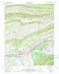
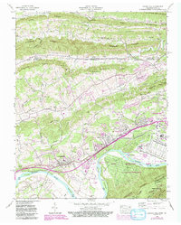
1959 Map of Church Hill
USGS Topo · Published 1989About this map
Clinch Mountain and a series of parallel ridges dominate this landscape where the Southern Railway follows the low ground toward Kingsport. The era's industrial footprint is clearly visible south of Block City, where the sprawling Holston Army Ammunition Plant occupies a large bend in the Holston River across from Smith Island. This facility, a major regional employer, is served by its own Inter-Plant Railroad and sits adjacent to the residential growth of Church Hill.
Find a feature on this map
97 named features on this map. Tap any name to fly to it.
Don’t see what you’re looking for? This feature index may not catch every label — zoom into the map to look around manually.
Map Details
Editions of this 1959 Church Hill Map
5 editions found
Other maps of this area

1892 · Greeneville
USGS Topo · 1:125,000

1894 · Estillville
USGS Topo · 1:125,000

1896 · Greeneville
USGS Topo · 1:125,000

1904 · Greeneville
USGS Topo · 1:125,000

1935 · Surgoinsville
USGS Topo · 1:48,000

1935 · Lovelace
USGS Topo · 1:24,000

1935 · Sullivan Gardens
USGS Topo · 1:24,000

1935 · Moggasin
USGS Topo · 1:48,000

1935 · Kingsport
USGS Topo · 1:24,000

1935 · Clinchport
USGS Topo · 1:24,000