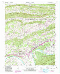
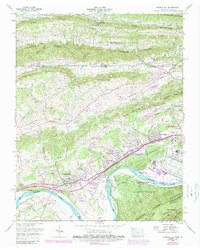
1959 Map of Church Hill
USGS Topo · Published 1993About this map
The Holston River winds through this landscape, defining the boundaries between McPheeter Bend, Solitude Bend, and Smith Bend. The southern portion of the map is dominated by the sprawling Holston Army Ammunition Plant, a massive industrial and military complex established as a U.S. Military Reservation along the riverbanks. This infrastructure contrasts with the rural character of the northern ridges and valleys, where family-named landmarks like Bradshaw Mill and Hord Mill suggest a history of localized water-powered industry.
Find a feature on this map
108 named features on this map. Tap any name to fly to it.
Don’t see what you’re looking for? This feature index may not catch every label — zoom into the map to look around manually.
Map Details
Editions of this 1959 Church Hill Map
5 editions found
Other maps of this area

1892 · Greeneville
USGS Topo · 1:125,000

1894 · Estillville
USGS Topo · 1:125,000

1896 · Greeneville
USGS Topo · 1:125,000

1904 · Greeneville
USGS Topo · 1:125,000

1935 · Surgoinsville
USGS Topo · 1:48,000

1935 · Lovelace
USGS Topo · 1:24,000

1935 · Sullivan Gardens
USGS Topo · 1:24,000

1935 · Moggasin
USGS Topo · 1:48,000

1935 · Kingsport
USGS Topo · 1:24,000

1935 · Clinchport
USGS Topo · 1:24,000