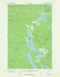
1962 Map of Churchill Lake
USGS Topo · Published 1964About this map
Logistics and timber transport define this remote northern wilderness, centered on the expansive waters of Churchill Lake and Eagle Lake. The map details a landscape shaped by the logging industry, most notably an Abandoned Tramway and an Old Railroad Grade that once facilitated the movement of timber between these interconnected basins. Near the northern end of Churchill Lake, the Churchill Depot stands as a focal point for operations, while the Tramway State Forest Service Camp marks a more modern state presence.
Find a feature on this map
76 named features on this map. Tap any name to fly to it.
Don’t see what you’re looking for? This feature index may not catch every label — zoom into the map to look around manually.
Map Details
Editions of this 1962 Churchill Lake Map
3 editions found
Other maps of this area

1932 · Umsaskis Lake
USGS Topo · 1:48,000

1932 · Musquacook Lakes
USGS Topo · 1:48,000

1935 · Umsaskis Lake
USGS Topo · 1:62,500

1935 · Musquacook Lakes
USGS Topo · 1:62,500

1953 · Telos Lake
USGS Topo · 1:62,500

1954 · Chesuncook
USGS Topo · 1:62,500

1954 · Spider Lake
USGS Topo · 1:62,500

1954 · Caucomgomoc Lake
USGS Topo · 1:62,500

1954 · Churchill Lake
USGS Topo · 1:62,500

1954 · Allagash Lake
USGS Topo · 1:62,500