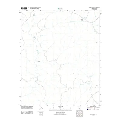
2011 Map of Cibecue Peak
USGS Topo · Published 2011About this map
Cibecue Peak stands as the primary landmark in this drainage-rich portion of Gila County, where the landscape is defined by the winding course of Cibecue Creek and its many tributaries. The area is characterized by an extensive system of canyons and natural water sources, including Indian Canyon, Cibecue Canyon, and Fox Canyon. These features indicate a terrain where water management is historically critical, evidenced by numerous named springs and tanks like Wool Cutter Spring, Cat Claw Spring, and Turkey Roost Tank. Transportation through the area is limited to rugged corridors such as Cibecue Rd and Indian Rte 12, which follow the natural contours of the land. The distribution of features like Blue Fox Tank and Jackrabbit Tank suggests a landscape utilized for livestock or wildlife management within the canyon systems.
Find a feature on this map
30 named features on this map. Tap any name to fly to it.
Don’t see what you’re looking for? This feature index may not catch every label — zoom into the map to look around manually.
Map Details
Editions of this 2011 Cibecue Peak Map
This is the sole edition of this map. No revisions or reprints were ever made.
Other maps of this area

1886 · Holbrook
USGS Topo · 1:250,000

1893 · Holbrook
USGS Topo · 1:250,000

1922 · Chrysotile
USGS Topo · 1:125,000

1946 · Blue House Mtn
USGS Topo · 1:62,500

1951 · Blue House Mtn
USGS Topo · 1:62,500

1954 · Holbrook
USGS Topo · 1:250,000

1954 · Mesa
USGS Topo · 1:250,000

1957 · Mesa
USGS Topo · 1:250,000

1957 · Holbrook
USGS Topo · 1:250,000

1958 · Mesa
USGS Topo · 1:250,000