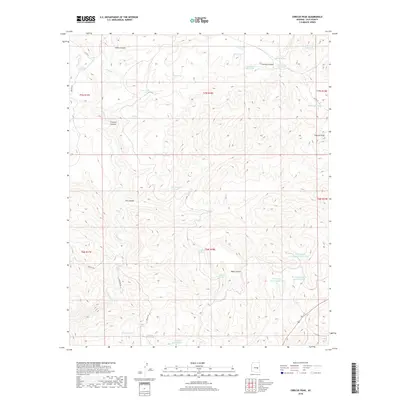
2018 Map of Cibecue Peak
USGS Topo · Published 2018About this map
Cibecue Peak rises over a landscape defined by deep drainages and vital water sources in this Gila County territory. The terrain is structured by massive cuts like Cibecue Canyon and Indian Canyon, where Cibecue Cr and its tributaries carve through the high ground. The distribution of named tanks and springs, such as Wool Cutter Spring, Jackrabbit Tank, and Turkey Roost Tank, reveals the essential water infrastructure required for ranching or land management in this arid environment. Roads like Cibecue Rd and Cemetery Rd provide access through the complex topography of Well Canyon and Cowboy Canyon. This 2018 survey detail reflects the continued importance of these named geographical points for navigating and managing the remote Arizona interior.
Find a feature on this map
38 named features on this map. Tap any name to fly to it.
Don’t see what you’re looking for? This feature index may not catch every label — zoom into the map to look around manually.
Map Details
Editions of this 2018 Cibecue Peak Map
This is the sole edition of this map. No revisions or reprints were ever made.
Other maps of this area

1886 · Holbrook
USGS Topo · 1:250,000

1893 · Holbrook
USGS Topo · 1:250,000

1922 · Chrysotile
USGS Topo · 1:125,000

1946 · Blue House Mtn
USGS Topo · 1:62,500

1951 · Blue House Mtn
USGS Topo · 1:62,500

1954 · Holbrook
USGS Topo · 1:250,000

1954 · Mesa
USGS Topo · 1:250,000

1957 · Mesa
USGS Topo · 1:250,000

1957 · Holbrook
USGS Topo · 1:250,000

1958 · Mesa
USGS Topo · 1:250,000