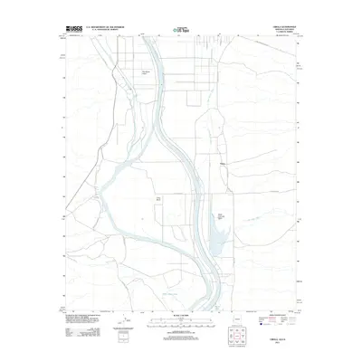
2011 Map of Cibola
USGS Topo · Published 2011About this map
The Colorado River carves a complex path through this desert landscape at the border of California and Arizona, defining the fertile reaches of the Palo Verde Valley and the Great Colorado Valley. In the early 21st century, the settlement of Cibola sits east of the main channel, surrounded by an intricate network of desert washes including Crazy Woman Wash and Hart Mine Wash. The hydrology of the area is particularly distinct at Long Bend, where the river's movement has created significant features like Three Finger Lake and Cibola Lake. The eastern portion of the map is dominated by the vast restricted acreage of the Yuma Proving Ground. Local infrastructure, such as Walters Camp Rd and Mitchells Camp Rd, provides access to the riverbanks, while the C-28 Canal highlights the region's reliance on managed water systems for valley agriculture.
Find a feature on this map
22 named features on this map. Tap any name to fly to it.
Don’t see what you’re looking for? This feature index may not catch every label — zoom into the map to look around manually.
Map Details
Editions of this 2011 Cibola Map
This is the sole edition of this map. No revisions or reprints were ever made.
Other maps of this area

1942 · Blythe
USGS Topo · 1:250,000

1945 · Cibola
USGS Topo · 1:62,500

1945 · Picacho
USGS Topo · 1:62,500

1951 · Picacho
USGS Topo · 1:62,500

1951 · Cibola
USGS Topo · 1:62,500

1952 · Mule Wash
USGS Topo · 1:24,000

1952 · Palo Verde
USGS Topo · 1:24,000

1953 · Palo Verde Mountains
USGS Topo · 1:62,500

1953 · Quartz Peak
USGS Topo · 1:62,500

1954 · Salton Sea
USGS Topo · 1:250,000