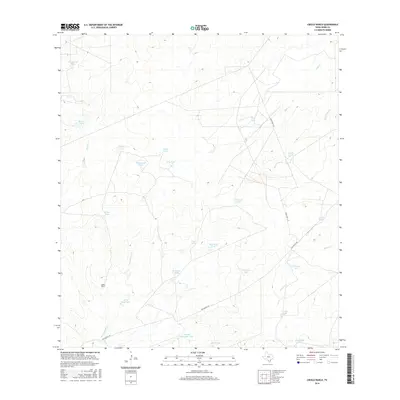
2016 Map of Cibolo Ranch
USGS Topo · Published 2016About this map
Cibolo Ranch serves as the primary landmark in this ranching-focused landscape of Webb County. The terrain is defined by an extensive network of ephemeral drainages and constructed stock ponds, reflecting the vital management of water in this semi-arid region. Watercourses such as San Ygnacio Cr, Chacon Cr, and Melone Cr wind through the hills, while numerous named reservoirs like Kuykendall Tank, De Cavasos Tank, and Huisache Tank dot the private lands. Human infrastructure is primarily limited to transit and ranching operations, with San Ignacio Rd and Ranch Rd 71321 providing the only major access through the area. A rare natural water source, El Pato Spring, stands out among the many man-made tanks, suggesting a long-standing point of importance for local livestock and wildlife in this quiet portion of South Texas.
Find a feature on this map
29 named features on this map. Tap any name to fly to it.
Don’t see what you’re looking for? This feature index may not catch every label — zoom into the map to look around manually.
Map Details
Editions of this 2016 Cibolo Ranch Map
This is the sole edition of this map. No revisions or reprints were ever made.
Other maps of this area

1937 · Aguilete Creek
USGS Topo · 1:62,500

1956 · Becerra
USGS Topo · 1:62,500

1956 · Laredo East
USGS Topo · 1:62,500

1956 · Webb
USGS Topo · 1:62,500

1956 · Laredo
USGS Topo · 1:250,000

1965 · Orvil
USGS Topo · 1:24,000

1965 · Cibolo Ranch
USGS Topo · 1:24,000

1965 · Tios Creek
USGS Topo · 1:24,000

1965 · Laredo East
USGS Topo · 1:24,000
1980 · Callaghan Ranch SE
USGS Topo · 1:24,000