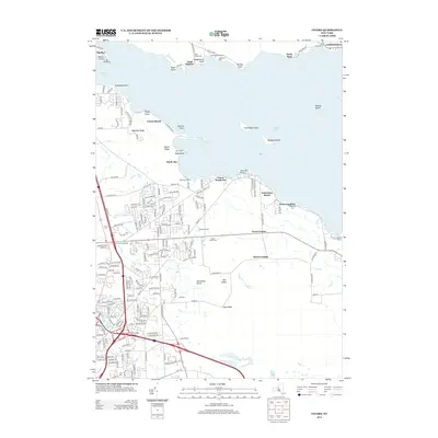
2013 Map of Cicero
USGS Topo · Published 2013About this map
Oneida Lake dominates this landscape, defining the northern boundaries of Lower South Bay and the quiet shoreline communities of Valentines Beach and Forest Beach. The map reveals a transition from the established settlements at Constantia and Cicero Center to the specialized agricultural lands of Tassone Farms and Joss Farm. A significant concentration of burial sites, including Toad Harbor Cem, McAllister Cem, and Terpenning Cem, provides valuable location data for genealogists tracking early families in the region. The map also charts the numerous islands and points along the lake, such as Frenchman Island, Dunham Island, and Phillips Point, which have historically served as landmarks for navigation and local recreation. Modern infrastructure is represented by the Cicero Interchange, showing the road network that connects these lakeside hamlets to the broader county.
Find a feature on this map
182 named features on this map. Tap any name to fly to it.
Don’t see what you’re looking for? This feature index may not catch every label — zoom into the map to look around manually.
Map Details
Editions of this 2013 Cicero Map
This is the sole edition of this map. No revisions or reprints were ever made.
Other maps of this area

1895 · Chittenango
USGS Topo · 1:62,500

1895 · Syracuse
USGS Topo · 1:62,500

1898 · Syracuse
USGS Topo · 1:62,500

1898 · Chittenango
USGS Topo · 1:62,500

1902 · Chittenango
USGS Topo · 1:62,500

1905 · Mexico
USGS Topo · 1:62,500

1906 · Kasoag
USGS Topo · 1:62,500

1938 · Syracuse East
USGS Topo · 1:24,000

1939 · Syracuse West
USGS Topo · 1:24,000

1940 · Brewerton
USGS Topo · 1:24,000