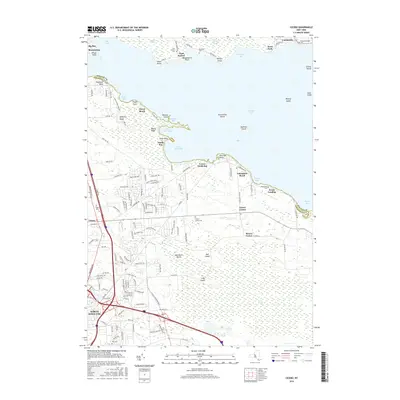
2016 Map of Cicero
USGS Topo · Published 2016About this map
Oneida Lake defines the northern reaches of this Onondaga County landscape, where various points and bays such as Muskrat Bay and Norcross Point shape a busy shoreline of summer communities and landings. The transition from the water's edge into the interior is marked by the sprawling Cicero Swamp, an expansive wetland that separates the lakeside settlements of Forest Beach and Valentines Beach from the growing suburban developments around North Syracuse. This 2016 survey provides a modern layout of the region's long-established infrastructure, including the intersections of Brewerton Rd and several historical burial grounds. Genealogists can locate numerous local landmarks including the Cicero Center Cem, Terpenning Cem, and Taft Cem. The map further details the complex geography of the lake itself, featuring Frenchman Island and Dunham Island alongside the small fishing landings of Kraus Landing and Doris Park on the northern shore.
Find a feature on this map
137 named features on this map. Tap any name to fly to it.
Don’t see what you’re looking for? This feature index may not catch every label — zoom into the map to look around manually.
Map Details
Editions of this 2016 Cicero Map
This is the sole edition of this map. No revisions or reprints were ever made.
Other maps of this area

1895 · Chittenango
USGS Topo · 1:62,500

1895 · Syracuse
USGS Topo · 1:62,500

1898 · Syracuse
USGS Topo · 1:62,500

1898 · Chittenango
USGS Topo · 1:62,500

1902 · Chittenango
USGS Topo · 1:62,500

1905 · Mexico
USGS Topo · 1:62,500

1906 · Kasoag
USGS Topo · 1:62,500

1938 · Syracuse East
USGS Topo · 1:24,000

1939 · Syracuse West
USGS Topo · 1:24,000

1940 · Brewerton
USGS Topo · 1:24,000