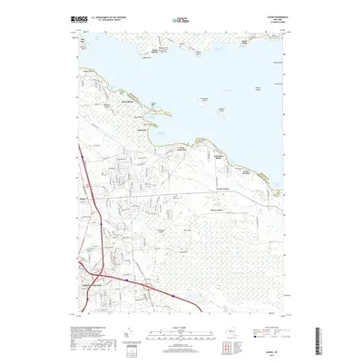
2019 Map of Cicero
USGS Topo · Published 2019About this map
Oneida Lake dominates the northern reaches of this territory, where the shoreline is defined by a sequence of points and bays including Toad Harbor and Muskrat Bay. The landscape transitions from the open waters and islands like Frenchman Island into the significant wetlands of the Cicero Swamp, which stretches across the southern half of the map. This area preserves traces of earlier infrastructure, most notably the route of an Electric Railway that once connected these lakeside communities. The map provides a detailed view of the growing suburbs of North Syracuse and Cicero, contrasted with the smaller lakeside clusters at Kraus Landing and Valentines Beach. Family and community history is anchored by numerous small burial grounds, such as Terpenning Cem and the Cicero Center Cem, which remain as markers of the area's long-standing rural settlements.
Find a feature on this map
142 named features on this map. Tap any name to fly to it.
Don’t see what you’re looking for? This feature index may not catch every label — zoom into the map to look around manually.
Map Details
Editions of this 2019 Cicero Map
This is the sole edition of this map. No revisions or reprints were ever made.
Other maps of this area

1895 · Chittenango
USGS Topo · 1:62,500

1895 · Syracuse
USGS Topo · 1:62,500

1898 · Syracuse
USGS Topo · 1:62,500

1898 · Chittenango
USGS Topo · 1:62,500

1902 · Chittenango
USGS Topo · 1:62,500

1905 · Mexico
USGS Topo · 1:62,500

1906 · Kasoag
USGS Topo · 1:62,500

1938 · Syracuse East
USGS Topo · 1:24,000

1939 · Syracuse West
USGS Topo · 1:24,000

1940 · Brewerton
USGS Topo · 1:24,000