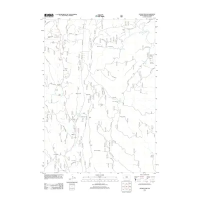
2012 Map of Cicero Peak
USGS Topo · Published 2012About this map
Cicero Peak dominates this section of the Black Hills, serving as a central point for a landscape defined by ranching homesteads and mountain drainage systems. Small settlements and family holdings like Nihart, Sutherland Ranch, and Tanner Ranch are scattered along the valley floors, particularly near Beaver Cr and Flynn Cr. The presence of Nihart Spring and Sutherland Spring highlights the critical importance of water sources for these upland operations. To the north, the terrain transitions into a more recreational character near Lake of the Pines and the Hazelrodt Summer Homes. The road network, including the Hazelrodt Cutoff and Sidney Park Rd, follows the natural contours of the ridges and canyons, such as Haven Canyon, connecting these isolated western South Dakota outposts.
Find a feature on this map
48 named features on this map. Tap any name to fly to it.
Don’t see what you’re looking for? This feature index may not catch every label — zoom into the map to look around manually.
Map Details
Editions of this 2012 Cicero Peak Map
This is the sole edition of this map. No revisions or reprints were ever made.
Other maps of this area

1894 · Hermosa
USGS Topo · 1:125,000

1896 · Harney Peak
USGS Topo · 1:125,000

1901 · Hermosa
USGS Topo · 1:125,000

1901 · Harney Peak
USGS Topo · 1:125,000

1954 · Iron Mountain
USGS Topo · 1:24,000

1954 · Fourmile
USGS Topo · 1:24,000

1954 · Custer
USGS Topo · 1:24,000

1954 · Berne
USGS Topo · 1:24,000

1954 · Mount Rushmore
USGS Topo · 1:62,500

1955 · Mt. Coolidge
USGS Topo · 1:24,000