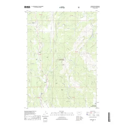
2017 Map of Cicero Peak
USGS Topo · Published 2017About this map
Cicero Peak and the high ridges of the Black Hills National Forest define this landscape, where the southern reaches of the hills descend toward Wind Cave National Park. Small residential pockets such as Sanator and Nihart are linked by a complex network of forest roads and draws, including Bowman Draw and Bowman Ridge. The presence of the Custer County Airport in the northwest corner near Echo Valley highlights the modern connectivity of this mountain region. The drainage patterns of French Cr and Beaver Cr provide the primary water sources for the area, supplemented by local landmarks like Lake of the Pines and Nihart Spring. This survey documents the transition from the forested heights of the Black Hills to the open canyon lands of Haven Canyon.
Find a feature on this map
88 named features on this map. Tap any name to fly to it.
Don’t see what you’re looking for? This feature index may not catch every label — zoom into the map to look around manually.
Map Details
Editions of this 2017 Cicero Peak Map
This is the sole edition of this map. No revisions or reprints were ever made.
Other maps of this area

1894 · Hermosa
USGS Topo · 1:125,000

1896 · Harney Peak
USGS Topo · 1:125,000

1901 · Hermosa
USGS Topo · 1:125,000

1901 · Harney Peak
USGS Topo · 1:125,000

1954 · Iron Mountain
USGS Topo · 1:24,000

1954 · Fourmile
USGS Topo · 1:24,000

1954 · Custer
USGS Topo · 1:24,000

1954 · Berne
USGS Topo · 1:24,000

1954 · Mount Rushmore
USGS Topo · 1:62,500

1955 · Mt. Coolidge
USGS Topo · 1:24,000