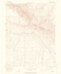
1956 Map of Cimarron
USGS Topo · Published 1962About this map
Black Canyon of the Gunnison River cuts a deep, dramatic path across this mid-century topographic study, defining the transition between the high plateaus of Black Mesa and Poverty Mesa. The settlement of Cimarron sits as a central node where Cimarron Creek meets the river canyon, reflecting a landscape defined by water management and early transportation. An Old Railroad Grade winds through the hills north of the creek, tracing the vanished route of the narrow-gauge tracks that once connected this remote region.
Find a feature on this map
25 named features on this map. Tap any name to fly to it.
Don’t see what you’re looking for? This feature index may not catch every label — zoom into the map to look around manually.
Map Details
Editions of this 1956 Cimarron Map
4 editions found
Other maps of this area

1908 · Uncompahgre
USGS Topo · 1:125,000

1909 · Montrose
USGS Topo · 1:125,000

1911 · Uncompahgre
USGS Topo · 1:125,000

1911 · Montrose
USGS Topo · 1:125,000

1956 · Curecanti Needle
USGS Topo · 1:24,000

1956 · Cimarron
USGS Topo · 1:24,000

1956 · Montrose
USGS Topo · 1:250,000

1957 · Cathedral Peak
USGS Topo · 1:24,000

1957 · X Lazy F Ranch
USGS Topo · 1:24,000

1957 · Cerro Summit
USGS Topo · 1:24,000