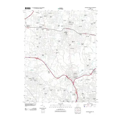
2010 Map of Cincinnati West
USGS Topo · Published 2010About this map
The suburban expansion of western Cincinnati and Hamilton County is recorded in detail, showing a landscape defined by residential developments like Wardwood Acres, Galaxy Acres, and Autumn Acres. The area around Mount Healthy and North College Hill serves as a central hub for the surrounding neighborhoods, with several post offices such as the College Hill Station and Groesbeck Branch serving as local anchors. This 2010 survey highlights a significant concentration of burial grounds and institutions, including the Arlington Memorial Gardens and Saint Johns German Catholic Cemetery, alongside landmarks like the Abbe Meteorological Observatory and the University of Cincinnati. The industrial and transit character of the lower Mill Creek valley is evident near Knowltons Corner, where the Hopple Street Viaduct and Western Hills Viaduct bridge the complex network of valley infrastructure.
Find a feature on this map
127 named features on this map. Tap any name to fly to it.
Don’t see what you’re looking for? This feature index may not catch every label — zoom into the map to look around manually.
Map Details
Editions of this 2010 Cincinnati West Map
This is the sole edition of this map. No revisions or reprints were ever made.
Other maps of this area

1898 · East Cincinnati
USGS Topo · 1:62,500

1904 · Mason
USGS Topo · 1:62,500

1906 · Mason
USGS Topo · 1:62,500

1914 · East Cincinnati
USGS Topo · 1:62,500

1914 · West Cincinnati
USGS Topo · 1:62,500

1915 · Hamilton
USGS Topo · 1:62,500

1917 · Hamilton
USGS Topo · 1:62,500

1950 · Covington
USGS Topo · 1:24,000

1951 · Burlington
USGS Topo · 1:24,000

1952 · Newport
USGS Topo · 1:24,000