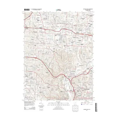
2013 Map of Cincinnati West
USGS Topo · Published 2013About this map
Mount Healthy and North College Hill anchor this detailed study of the suburban and urban landscape northwest of downtown Cincinnati. The map captures a high density of mid-to-late 20th-century residential developments, including named neighborhoods like Galaxy Acres, White Oak Meadows, and Hollywood Estates. Central to the area's geography is the expansive Mount Airy Forest, which provides a significant break in the dense street grid. Local history and genealogy are well-represented by numerous burial grounds, such as the sprawling Spring Grove Cem and Arlington Memorial Gardens Cem. The southern portion of the sheet reveals the industrial and institutional character of the city, showing the Univ of Cincinnati-Main Campus and Nippert Stadium, alongside the Mill Creek corridor. This 2013 survey provides a clear look at the modern infrastructure connecting these communities, from the Hopple Street Viaduct to the Queen City Byp.
Find a feature on this map
112 named features on this map. Tap any name to fly to it.
Don’t see what you’re looking for? This feature index may not catch every label — zoom into the map to look around manually.
Map Details
Editions of this 2013 Cincinnati West Map
This is the sole edition of this map. No revisions or reprints were ever made.
Other maps of this area

1898 · East Cincinnati
USGS Topo · 1:62,500

1904 · Mason
USGS Topo · 1:62,500

1906 · Mason
USGS Topo · 1:62,500

1914 · East Cincinnati
USGS Topo · 1:62,500

1914 · West Cincinnati
USGS Topo · 1:62,500

1915 · Hamilton
USGS Topo · 1:62,500

1917 · Hamilton
USGS Topo · 1:62,500

1950 · Covington
USGS Topo · 1:24,000

1951 · Burlington
USGS Topo · 1:24,000

1952 · Newport
USGS Topo · 1:24,000