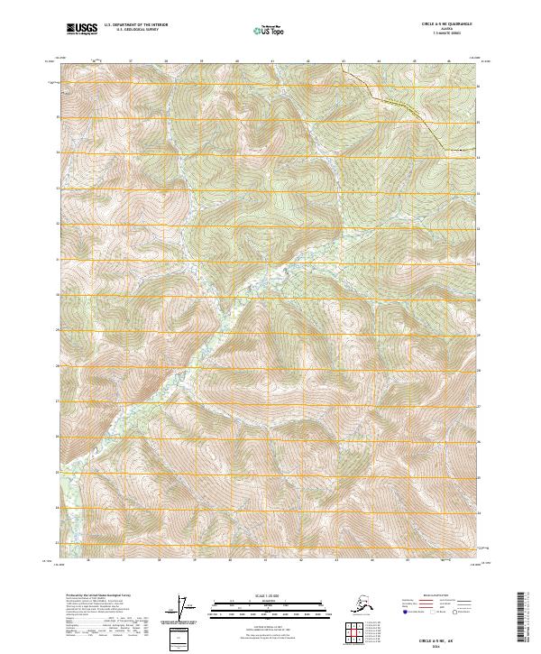
2024 Map of Circle A-5 NE
USGS Topo · Published 2024About this map
Mt Ryan anchors the northwest corner of this interior Alaskan landscape, where the high elevations of the White Mountains give way to the complex drainage systems of the upper Chena watershed. The West Fork Chena River meanders through the central valley, creating a corridor of lower-elevation terrain between the surrounding peaks. This waterway is joined by smaller tributaries like King Creek, illustrating the natural hydrologic patterns of the region. The map also delineates the boundary for the Fairbanks North Star Borough, marking a transition between administrative zones in this sparsely populated portion of the interior. The lack of roads or structures indicates a wilderness area defined by its topography and river systems.
Find a feature on this map
9 named features on this map. Tap any name to fly to it.
Don’t see what you’re looking for? This feature index may not catch every label — zoom into the map to look around manually.
Map Details
Editions of this 2024 Circle A-5 NE Map
This is the sole edition of this map. No revisions or reprints were ever made.
Other maps of this area

1951 · Circle
USGS Topo · 1:250,000

1951 · Circle A-5
USGS Topo · 1:63,360

1952 · Circle A-4
USGS Topo · 1:63,360

1952 · Circle B-4
USGS Topo · 1:63,360

1952 · Circle A-5
USGS Topo · 1:63,360

1954 · Circle A-5
USGS Topo · 1:63,360

1954 · Circle B-5
USGS Topo · 1:63,360

1955 · Circle
USGS Topo · 1:250,000

1964 · Circle
USGS Topo · 1:250,000
2018 · Circle B-5 SW
USGS Topo · 1:25,000