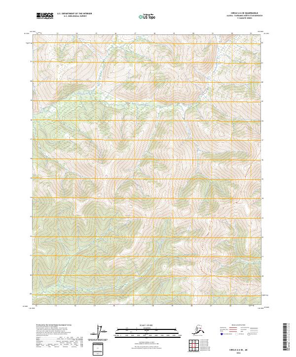
2024 Map of Circle A-6 SE
USGS Topo · Published 2024About this map
Little Chena River winds across the interior landscape of the Fairbanks North Star Borough, serving as a primary drainage for the surrounding highlands. This area, largely defined by its natural watercourses, is further shaped by Anaconda Creek and Colorado Creek as they flow through the township and range divisions of T4N, T3N, and T2N. The lack of modern roads or structural developments in this sector underscores the wilderness character of the interior, where the terrain is governed by the elevations of the watershed rather than human settlement. Researchers and geologists can observe the precise intersections of these waterways with the established Public Land Survey System lines, which provide a reliable grid for understanding the geography of the Alaska interior.
Find a feature on this map
9 named features on this map. Tap any name to fly to it.
Don’t see what you’re looking for? This feature index may not catch every label — zoom into the map to look around manually.
Map Details
Editions of this 2024 Circle A-6 SE Map
This is the sole edition of this map. No revisions or reprints were ever made.
Other maps of this area

1950 · Big Delta
USGS Topo · 1:250,000

1950 · Big Delta D-6
USGS Topo · 1:63,360

1951 · Big Delta
USGS Topo · 1:250,000

1951 · Circle
USGS Topo · 1:250,000

1951 · Circle A-5
USGS Topo · 1:63,360

1952 · Big Delta D-6
USGS Topo · 1:63,360

1952 · Circle A-5
USGS Topo · 1:63,360

1954 · Circle A-6
USGS Topo · 1:63,360

1954 · Circle A-5
USGS Topo · 1:63,360

1955 · Circle
USGS Topo · 1:250,000