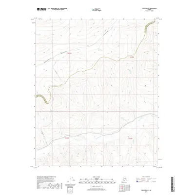
2018 Map of Circle B-6 SE
USGS Topo · Published 2018About this map
The Chatanika River valley defines the lower half of this interior Alaska landscape, serving as a central drainage for numerous tributaries flowing from the high ridges to the north and south. This 2018 survey documents a remote corridor along the boundary of the Fairbanks North Star Borough, where the high-altitude terrain is accessible primarily via primitive routes like Nome Creek East Road and U.S. Creek Road. The drainage pattern is exceptionally detailed, showing the intricate network of seasonal and perennial streams including Cripple Cr, Medicine Cr, and Little Caribou Cr. These waterways are critical landmarks in a region defined by its vast public lands and lack of traditional townsites, providing essential orientation for modern backcountry navigation and historical placer mining interest along Nome Cr and Moose Cr.
Find a feature on this map
23 named features on this map. Tap any name to fly to it.
Don’t see what you’re looking for? This feature index may not catch every label — zoom into the map to look around manually.
Map Details
Editions of this 2018 Circle B-6 SE Map
This is the sole edition of this map. No revisions or reprints were ever made.
Other maps of this area

1951 · Circle
USGS Topo · 1:250,000

1951 · Circle A-5
USGS Topo · 1:63,360

1952 · Circle A-5
USGS Topo · 1:63,360

1954 · Circle A-6
USGS Topo · 1:63,360

1954 · Circle B-6
USGS Topo · 1:63,360

1954 · Circle A-5
USGS Topo · 1:63,360

1954 · Circle B-5
USGS Topo · 1:63,360

1955 · Circle
USGS Topo · 1:250,000

1964 · Circle
USGS Topo · 1:250,000
2018 · Circle B-5 SW
USGS Topo · 1:25,000