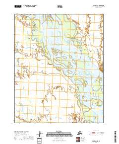
2018 Map of Circle D-1 NE
USGS Topo · Published 2018About this map
The Yukon River dominates this landscape in the Yukon-Koyukuk Census Area, manifesting as a complex network of braided channels, gravel bars, and forested islands. This segment of the river corridor illustrates a highly dynamic fluvial environment where the water course shifts across a broad floodplain, creating a mosaic of wetlands and side sloughs. The lack of named settlements or infrastructure highlights the isolation of this interior Alaska region, where the primary geographic markers are the Public Land Survey System boundaries such as t13n r17e and t14n r18e. The intricate pattern of the river's path through the low-lying terrain reveals the seasonal influence of ice and high water on the topography of the Yukon flats.
Find a feature on this map
7 named features on this map. Tap any name to fly to it.
Don’t see what you’re looking for? This feature index may not catch every label — zoom into the map to look around manually.
Map Details
Editions of this 2018 Circle D-1 NE Map
This is the sole edition of this map. No revisions or reprints were ever made.
Other maps of this area

1951 · Fort Yukon
USGS Topo · 1:250,000

1951 · Charley River
USGS Topo · 1:250,000

1951 · Black River
USGS Topo · 1:250,000

1951 · Circle
USGS Topo · 1:250,000

1955 · Circle D-1
USGS Topo · 1:63,360

1955 · Circle
USGS Topo · 1:250,000

1956 · Fort Yukon A-1
USGS Topo · 1:63,360

1956 · Black River A-6
USGS Topo · 1:63,360

1956 · Fort Yukon
USGS Topo · 1:250,000

1956 · Black River
USGS Topo · 1:250,000