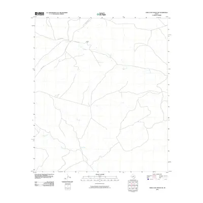
2010 Map of Circle Dot Ranch NE
USGS Topo · Published 2010About this map
Mitchell Ranch sits near the upper reaches of Dry Creek in this remote stretch of West Texas ranching country. The landscape is defined by an intricate network of intermittent drainage patterns, including the winding course of McKay Creek as it moves toward the south. Modern access to these family-held lands is provided by a series of graded routes such as Ranch Rd 2400, Dad's Creek Rd, and Dry Creek Rd. This 2010 survey illustrates the sparse, high-desert character of the region, where roads primarily follow the natural contours of the arroyos and ridges. For the researcher or land historian, the map documents the specific property names and transportation infrastructure that sustained large-scale livestock operations in the early 21st century.
Find a feature on this map
6 named features on this map. Tap any name to fly to it.
Don’t see what you’re looking for? This feature index may not catch every label — zoom into the map to look around manually.
Map Details
Editions of this 2010 Circle Dot Ranch NE Map
This is the sole edition of this map. No revisions or reprints were ever made.
Other maps of this area

1928 · Sanderson
USGS Topo · 1:125,000

1929 · Sheffield
USGS Topo · 1:125,000

1929 · Independence Draw Quadrangle
USGS Topo · 1:125,000

1954 · Fort Stockton
USGS Topo · 1:250,000

1954 · Sonora
USGS Topo · 1:250,000

1958 · Sonora
USGS Topo · 1:250,000

1958 · Fort Stockton
USGS Topo · 1:250,000

1967 · Horsehead Canyon
USGS Topo · 1:24,000

1969 · Circle Dot Ranch
USGS Topo · 1:24,000

1969 · Continental Ranch
USGS Topo · 1:24,000