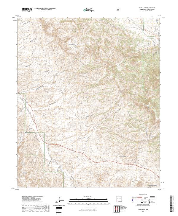
2023 Map of Circle Mesa
USGS Topo · Published 2023About this map
Circle Mesa rises as a central landmark in this southwestern corner of the Gila National Forest, defining a high-desert landscape of deeply incised drainages and prominent peaks. The western edge of the quadrangle is dominated by the Mangas Valley, where the waters of Mangas Creek flow through a corridor of rangeland and remote canyons. This 2023 survey illustrates a modern recreation and ranching landscape, notably where the Continental Divide National Scenic Trl traverses the high ground between the Little Burro Mountains and the Big Burro Mountains.
Find a feature on this map
44 named features on this map. Tap any name to fly to it.
Don’t see what you’re looking for? This feature index may not catch every label — zoom into the map to look around manually.
Map Details
Editions of this 2023 Circle Mesa Map
This is the sole edition of this map. No revisions or reprints were ever made.
Other maps of this area

1909 · Silver City
USGS Topo · 1:125,000

1949 · Circle Mesa
USGS Topo · 1:24,000

1950 · Tyrone
USGS Topo · 1:24,000

1950 · Dorsey Ranch
USGS Topo · 1:24,000

1950 · Wind Mountain
USGS Topo · 1:24,000

1950 · Silver City
USGS Topo · 1:24,000

1950 · Reading Mountain
USGS Topo · 1:24,000

1951 · Circle Mesa
USGS Topo · 1:24,000

1951 · Dorsey Ranch
USGS Topo · 1:24,000
1951 · Silver City
USGS Topo · 1:24,000