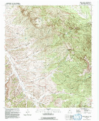
1992 Map of Circle Mesa
USGS Topo · Published 1992About this map
Mangas Creek carves a significant valley through this portion of Grant County, dividing the high plateaus of Circle Mesa and L S Mesa from the foothills of the Burro Mountains. The landscape in the early 1990s reflects a high-desert environment defined by complex drainages like Blacksmith Canyon and Cottonwood Canyon, where isolated water sources such as Cane Spring and Ash Spring were vital landmarks for navigation and land use.
Find a feature on this map
23 named features on this map. Tap any name to fly to it.
Don’t see what you’re looking for? This feature index may not catch every label — zoom into the map to look around manually.
Map Details
Editions of this 1992 Circle Mesa Map
This is the sole edition of this map. No revisions or reprints were ever made.
Other maps of this area

1909 · Silver City
USGS Topo · 1:125,000

1949 · Circle Mesa
USGS Topo · 1:24,000

1950 · Tyrone
USGS Topo · 1:24,000

1950 · Dorsey Ranch
USGS Topo · 1:24,000

1950 · Wind Mountain
USGS Topo · 1:24,000

1950 · Silver City
USGS Topo · 1:24,000

1950 · Reading Mountain
USGS Topo · 1:24,000

1951 · Circle Mesa
USGS Topo · 1:24,000

1951 · Dorsey Ranch
USGS Topo · 1:24,000
1951 · Silver City
USGS Topo · 1:24,000