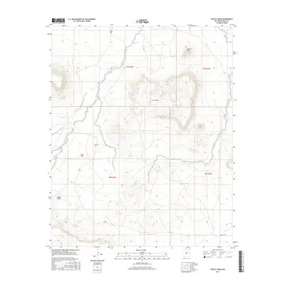
2017 Map of Circle S Mesa
USGS Topo · Published 2017About this map
Circle S Mesa dominates the central landscape of this Quay County terrain, where high flats and deep drainages define the regional character. Near the center of the sheet, the solitary West Cem sits as a quiet historical marker on West Flat, offering a vital point of reference for genealogists tracing early families in this part of eastern New Mexico. The area is defined by a network of seasonal watercourses including Crow Cr, Fish Cr, and Adobe Walls Cr, which have carved significant relief into the high plains.
Find a feature on this map
19 named features on this map. Tap any name to fly to it.
Don’t see what you’re looking for? This feature index may not catch every label — zoom into the map to look around manually.
Map Details
Editions of this 2017 Circle S Mesa Map
This is the sole edition of this map. No revisions or reprints were ever made.
Other maps of this area

1930 · Tucumcari
USGS Topo · 1:125,000

1954 · Santa Fe
USGS Topo · 1:250,000

1954 · Fort Sumner
USGS Topo · 1:250,000

1954 · Tucumcari
USGS Topo · 1:250,000

1954 · Clovis
USGS Topo · 1:250,000

1958 · Fort Sumner
USGS Topo · 1:250,000

1958 · Santa Fe
USGS Topo · 1:250,000

1958 · Clovis
USGS Topo · 1:250,000

1958 · Tucumcari
USGS Topo · 1:250,000
1964 · Montoya
USGS Topo · 1:24,000