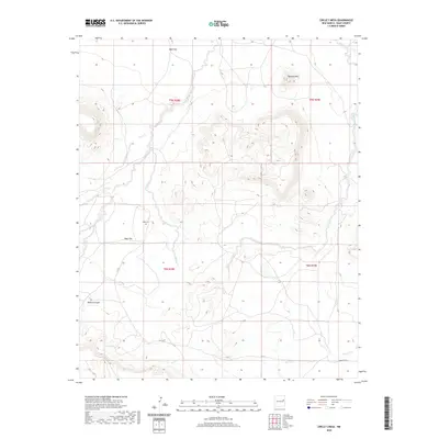
2020 Map of Circle S Mesa
USGS Topo · Published 2020About this map
Pyramid Mtn serves as a prominent landmark in this eastern New Mexico landscape, surrounded by high plateaus and complex drainage systems. The terrain is defined by broad expanses like Ogle Flat and West Flat, which give way to the deep cut of Bogard Canyon. A network of intermittent watercourses including Adobe Walls Cr, Charco Cr, and Garcia Cr dissects the mesa, illustrating the erosion patterns characteristic of the High Plains. Evidence of early settlement and land use remains visible through the presence of the West Cem and named water sources like Hern Spring. These features, along with the section lines and local roads such as Quay Road 43, provide essential points of reference for understanding the rural development and genealogy of this portion of Quay County.
Find a feature on this map
18 named features on this map. Tap any name to fly to it.
Don’t see what you’re looking for? This feature index may not catch every label — zoom into the map to look around manually.
Map Details
Editions of this 2020 Circle S Mesa Map
This is the sole edition of this map. No revisions or reprints were ever made.
Other maps of this area

1930 · Tucumcari
USGS Topo · 1:125,000

1954 · Santa Fe
USGS Topo · 1:250,000

1954 · Fort Sumner
USGS Topo · 1:250,000

1954 · Tucumcari
USGS Topo · 1:250,000

1954 · Clovis
USGS Topo · 1:250,000

1958 · Fort Sumner
USGS Topo · 1:250,000

1958 · Santa Fe
USGS Topo · 1:250,000

1958 · Clovis
USGS Topo · 1:250,000

1958 · Tucumcari
USGS Topo · 1:250,000
1964 · Montoya
USGS Topo · 1:24,000