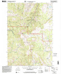
1997 Map of Cirque Lake
USGS Topo · Published 2002About this map
The Browns Gulch Mining District dominates the northern reaches of this map, revealing a landscape defined by intensive late-20th-century extraction efforts. Numerous workings like the Eastern Pacific Mine, Marietta Mine, and the General Shafter Mine are scattered across the high ridges, accompanied by various adits and mine shafts. This network of operations suggests a period of sustained interest in the mineral deposits of the Gravelly Range and Greenhorn Range, where industrial infrastructure is etched into the steep gulches.
Find a feature on this map
52 named features on this map. Tap any name to fly to it.
Don’t see what you’re looking for? This feature index may not catch every label — zoom into the map to look around manually.
Map Details
Editions of this 1997 Cirque Lake Map
This is the sole edition of this map. No revisions or reprints were ever made.
Other maps of this area

1888 · Three Forks
USGS Topo · 1:250,000

1893 · Dillon
USGS Topo · 1:250,000

1894 · Three Forks
USGS Topo · 1:250,000

1895 · Three Forks
USGS Topo · 1:250,000

1947 · Bozeman
USGS Topo · 1:250,000

1948 · Bozeman
USGS Topo · 1:250,000

1949 · Varney
USGS Topo · 1:62,500

1950 · Virginia City
USGS Topo · 1:62,500

1955 · Bozeman
USGS Topo · 1:250,000

1955 · Dillon
USGS Topo · 1:250,000