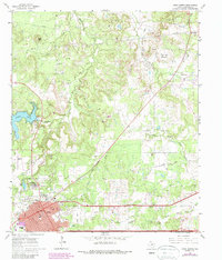
1966 Map of Cisco North
USGS Topo · Published 1987About this map
The Cisco street grid and the educational campus of Cisco Junior College anchor this West Texas landscape during a period of mid-century industrial activity and regional growth. Oil production is a dominant theme across the terrain, notably at the Bankline Oil Field, while numerous Oil Wells and a complex network of Pipelines dot the drainages of Sandy Creek and the North Fork Leon River.
Find a feature on this map
35 named features on this map. Tap any name to fly to it.
Don’t see what you’re looking for? This feature index may not catch every label — zoom into the map to look around manually.
Map Details
Editions of this 1966 Cisco North Map
2 editions found
Other maps of this area

1890 · Breckenridge
USGS Topo · 1:125,000

1892 · Albany
USGS Topo · 1:125,000

1893 · Albany
USGS Topo · 1:125,000

1894 · Eastland
USGS Topo · 1:125,000

1931 · Baird
USGS Topo · 1:125,000

1932 · Baird
USGS Topo · 1:125,000

1954 · Abilene
USGS Topo · 1:250,000

1958 · Abilene
USGS Topo · 1:250,000

1965 · Indian Knoll
USGS Topo · 1:24,000

1966 · Cisco North
USGS Topo · 1:24,000