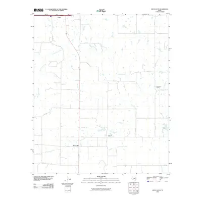
2010 Map of Cisco South
USGS Topo · Published 2010About this map
South Fork Leon River meanders across this West Texas landscape just south of Cisco, where a network of county roads defines the rural character of Eastland County. The settlement of Pleasant Hill serves as a local landmark, anchored by the nearby Pleasant Hill Cemetery. This area is characterized by its drainage systems, including Dead Horse Creek and Greer Creek, which feed into the larger river basin.
Find a feature on this map
33 named features on this map. Tap any name to fly to it.
Don’t see what you’re looking for? This feature index may not catch every label — zoom into the map to look around manually.
Map Details
Editions of this 2010 Cisco South Map
This is the sole edition of this map. No revisions or reprints were ever made.
Other maps of this area

1894 · Eastland
USGS Topo · 1:125,000

1931 · Baird
USGS Topo · 1:125,000

1932 · Baird
USGS Topo · 1:125,000

1954 · Abilene
USGS Topo · 1:250,000

1958 · Abilene
USGS Topo · 1:250,000

1966 · Cisco North
USGS Topo · 1:24,000

1966 · Carbon
USGS Topo · 1:24,000

1966 · Scranton
USGS Topo · 1:24,000

1966 · Eastland
USGS Topo · 1:24,000
1966 · Bernie Lake
USGS Topo · 1:24,000