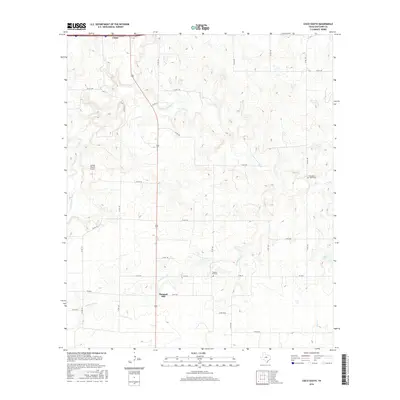
2016 Map of Cisco South
USGS Topo · Published 2016About this map
Pleasant Hill serves as a central point in this rural landscape south of Cisco, where the rolling terrain is defined by the drainage of the S Fork Leon River and Dead Horse Cr. The map illustrates a region heavily partitioned by a network of county roads, such as Co RD 180 and Co RD 184, reflecting a long-standing pattern of dispersed agricultural holdings and family ranching. Genealogists will find particular value in the documentation of the Pleasant Hill Cem and the Pleasant Valley Cem, which remain vital markers of the area's early community centers. The presence of the Spring Ranch Airport and the development near Griffin Lake in the southeast corner indicate more contemporary land uses while the primary landscape remains tied to the local creeks, including Greer Cr, which flow through the Eastland County countryside.
Find a feature on this map
35 named features on this map. Tap any name to fly to it.
Don’t see what you’re looking for? This feature index may not catch every label — zoom into the map to look around manually.
Map Details
Editions of this 2016 Cisco South Map
This is the sole edition of this map. No revisions or reprints were ever made.
Other maps of this area

1894 · Eastland
USGS Topo · 1:125,000

1931 · Baird
USGS Topo · 1:125,000

1932 · Baird
USGS Topo · 1:125,000

1954 · Abilene
USGS Topo · 1:250,000

1958 · Abilene
USGS Topo · 1:250,000

1966 · Cisco North
USGS Topo · 1:24,000

1966 · Carbon
USGS Topo · 1:24,000

1966 · Scranton
USGS Topo · 1:24,000

1966 · Eastland
USGS Topo · 1:24,000
1966 · Bernie Lake
USGS Topo · 1:24,000