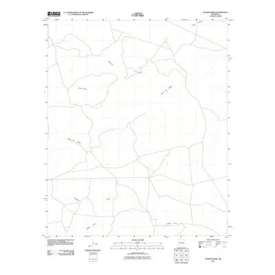
2010 Map of Cistern Draw
USGS Topo · Published 2010About this map
Arroyo del Macho winds across this arid New Mexico landscape, serving as a primary drainage for a region defined by its complex network of seasonal watercourses. This survey records a transitional terrain where broader channels like Cistern Draw and Hackberry Draw intersect with more incised features such as Hasperos Canyon. The map reveals a land structured by water movement and rural access, with local roads following the natural contours of the arroyos. The convergence of Middle Arroyo and other minor tributaries illustrates the intricate hydrology of Lincoln County, providing a clear record of the area's physical geography before modern land-use changes or further infrastructure development altered the natural drainage patterns of South Canyon.
Find a feature on this map
6 named features on this map. Tap any name to fly to it.
Don’t see what you’re looking for? This feature index may not catch every label — zoom into the map to look around manually.
Map Details
Editions of this 2010 Cistern Draw Map
This is the sole edition of this map. No revisions or reprints were ever made.
Other maps of this area

1936 · Arabela
USGS Topo · 1:48,000

1942 · Arabela
USGS Topo · 1:62,500

1955 · Roswell
USGS Topo · 1:250,000

1958 · Roswell
USGS Topo · 1:250,000

1962 · Roswell
USGS Topo · 1:250,000

1967 · North Lake
USGS Topo · 1:24,000

1967 · White Flat
USGS Topo · 1:24,000

1967 · Chivata Canyon
USGS Topo · 1:24,000
1979 · Salt Creek
USGS Topo · 1:100,000

1981 · Huff Hill
USGS Topo · 1:24,000