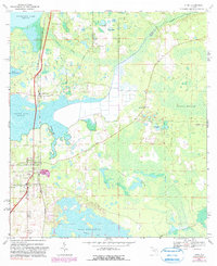
1967 Map of Citra
USGS Topo · Published 1990About this map
Island Grove and Citra anchor this North Florida landscape, where the Seaboard Coast Line railroad runs parallel to the western edges of Lochloosa Lake and Orange Lake. The terrain is defined by complex water systems, including the Lochloosa Slough and the expansive Black Sink Prairie, which features an Abandoned Canal. Local family history is preserved through the locations of several burial grounds, such as Antioch Cem, Carlton Cem, and Tompkins Cem, situated among the groves and prairies. The presence of Willow Plant Ch and St Johns Ch near Citra indicates established community centers within this citrus-growing region. Further east, the California Scrub and Waldron Millpond highlight the area's transition into more primitive wetlands and managed timberlands, marked by several firebreaks.
Find a feature on this map
26 named features on this map. Tap any name to fly to it.
Don’t see what you’re looking for? This feature index may not catch every label — zoom into the map to look around manually.
Map Details
Editions of this 1967 Citra Map
3 editions found
Other maps of this area

1893 · Citra
USGS Topo · 1:62,500

1895 · Citra
USGS Topo · 1:62,500

1915 · Interlachen
USGS Topo · 1:48,000

1916 · Interlachen
USGS Topo · 1:62,500

1938 · Hawthorn
USGS Topo · 1:48,000

1943 · Hawthorn
USGS Topo · 1:62,500

1944 · Interlachen
USGS Topo · 1:62,500

1949 · Keuka
USGS Topo · 1:24,000

1949 · Interlachen
USGS Topo · 1:62,500

1954 · Gainesville
USGS Topo · 1:250,000