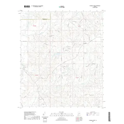
2018 Map of Citronelle West
USGS Topo · Published 2018About this map
Citronelle anchors the eastern edge of this landscape, where the boundary between Washington County and Mobile County defines the local geography. The area is characterized by a dense network of creek drainages, including the prominent Escatawpa River and the winding Lotts Mill Cr. These watercourses have long dictated the placement of early settlements and family lands. For those tracing local heritage, several burial grounds are preserved across the terrain, such as New Hope Cem, Baxter Will Cem, and Brannon Cem. The road system, including the Beverly Jeffries Hwy and Lott Rd, connects these rural points with Citronelle Lake, a notable feature near the town center. The map reveals a transition from organized town blocks to the scattered farmsteads and timberlands of the Alabama piney woods, documented through family-named routes like Robert Walker Rd and Phelan Howard Rd.
Find a feature on this map
66 named features on this map. Tap any name to fly to it.
Don’t see what you’re looking for? This feature index may not catch every label — zoom into the map to look around manually.
Map Details
Editions of this 2018 Citronelle West Map
This is the sole edition of this map. No revisions or reprints were ever made.
Other maps of this area

1941 · Creola
USGS Topo · 1:62,500

1942 · Deer Park
USGS Topo · 1:62,500

1942 · Wilmer
USGS Topo · 1:62,500

1943 · Creola
USGS Topo · 1:62,500

1943 · Deer Park
USGS Topo · 1:62,500

1943 · Citronelle
USGS Topo · 1:62,500

1944 · Wilmer
USGS Topo · 1:62,500

1946 · Citronelle
USGS Topo · 1:62,500

1953 · Hattiesburg
USGS Topo · 1:250,000

1953 · Mobile
USGS Topo · 1:250,000