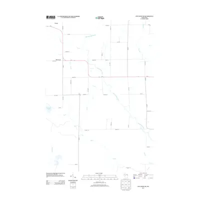
2013 Map of City Point NE
USGS Topo · Published 2013About this map
Sherwood and the hamlet of Nevins anchor this rural Clark County landscape, where the East Fork Black River snakes through a complex drainage network. The area's character is defined by its numerous watercourses, including Toms Cr, Rocky Run, and Lead Cr, which feed into the larger river system. A significant local landmark, Sherwood Lake, sits just west of the primary settlement, likely serving as a focal point for the surrounding community. The road network, dominated by Wi-73, follows a mix of rigid section-line grids and meandering paths that respect the low-lying hydrology. Many local roads carry the names of early settler families, such as Steffek Rd, Niemann Rd, and Accola Rd, providing a direct link to the region's genealogical and agricultural history. This survey illustrates a quiet, water-rich territory where the land remains primarily divided by family farms and timber tracts.
Find a feature on this map
38 named features on this map. Tap any name to fly to it.
Don’t see what you’re looking for? This feature index may not catch every label — zoom into the map to look around manually.
Map Details
Editions of this 2013 City Point NE Map
This is the sole edition of this map. No revisions or reprints were ever made.
Other maps of this area

1953 · Eau Claire
USGS Topo · 1:250,000

1954 · Granton
USGS Topo · 1:62,500

1954 · Marshfield
USGS Topo · 1:62,500

1957 · Pittsville
USGS Topo · 1:48,000

1957 · City Point
USGS Topo · 1:48,000

1958 · Eau Claire
USGS Topo · 1:250,000

1964 · Eau Claire
USGS Topo · 1:250,000

1967 · Pittsville
USGS Topo · 1:62,500

1970 · City Point NE
USGS Topo · 1:24,000

1970 · Spaulding
USGS Topo · 1:24,000