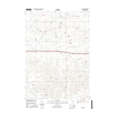
2016 Map of City Rock
USGS Topo · Published 2016About this map
Coles Valley and the surrounding coulee-style terrain define this portion of Monroe County, where complex ridges and rock formations overlook a landscape shaped by the La Crosse River and Silver Cr. Notable geological landmarks like Chimney Rock, Cave Rock, and Face Rock rise above the agricultural valley floors, while Summit Ridge and Sugarbush Hill dominate the southern heights. This mid-2010s survey reveals the intersection of military and civil infrastructure, with the Sparta/Fort McCoy Airport and the Young Tactical Landing Site situated alongside local settlements like Scotts Junction. Genealogists will find significant local history in the presence of several burial grounds, including the Mound Prairie Cem, County Cem, and Farmers Valley Cem, which anchor the rural community of Farmers Valley.
Find a feature on this map
84 named features on this map. Tap any name to fly to it.
Don’t see what you’re looking for? This feature index may not catch every label — zoom into the map to look around manually.
Map Details
Editions of this 2016 City Rock Map
This is the sole edition of this map. No revisions or reprints were ever made.
Other maps of this area

1909 · Sparta
USGS Topo · 1:62,500

1916 · Tomah
USGS Topo · 1:62,500

1928 · Melrose
USGS Topo · 1:48,000

1947 · Millston
USGS Topo · 1:62,500

1947 · Sparta
USGS Topo · 1:62,500

1949 · Millston
USGS Topo · 1:62,500

1949 · Sparta
USGS Topo · 1:62,500

1949 · Tomah
USGS Topo · 1:62,500

1949 · Melrose
USGS Topo · 1:62,500

1953 · Eau Claire
USGS Topo · 1:250,000