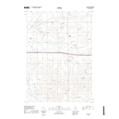
2018 Map of City Rock
USGS Topo · Published 2018About this map
Coles Valley and the surrounding Monroe County hillsides are defined by a complex network of topographical features and military infrastructure. The presence of the Sparta/Fort McCoy Airport and the Young Tactical Landing Site in the north indicates the strategic importance of this landscape, which is further marked by numerous named passes such as Lafayette Pass and Raymore Pass. This 2018 survey reveals a terrain punctuated by distinctive sandstone formations, including Chimney Rock, Jeff Davis Rock, and the eponymous City Rock. Local history is preserved in small burial sites like Mound Prairie Cem and Farmers Valley Cem, while the drainage of Farmers Valley Cr and the La Crosse River carves out the lowlands. The settlement at Scotts Junction serves as a small crossroad amidst a landscape of named knolls and bluffs.
Find a feature on this map
74 named features on this map. Tap any name to fly to it.
Don’t see what you’re looking for? This feature index may not catch every label — zoom into the map to look around manually.
Map Details
Editions of this 2018 City Rock Map
This is the sole edition of this map. No revisions or reprints were ever made.
Other maps of this area

1909 · Sparta
USGS Topo · 1:62,500

1916 · Tomah
USGS Topo · 1:62,500

1928 · Melrose
USGS Topo · 1:48,000

1947 · Millston
USGS Topo · 1:62,500

1947 · Sparta
USGS Topo · 1:62,500

1949 · Millston
USGS Topo · 1:62,500

1949 · Sparta
USGS Topo · 1:62,500

1949 · Tomah
USGS Topo · 1:62,500

1949 · Melrose
USGS Topo · 1:62,500

1953 · Eau Claire
USGS Topo · 1:250,000