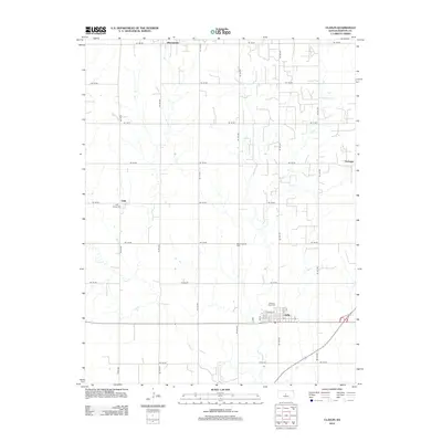
2012 Map of Claflin
USGS Topo · Published 2012About this map
Claflin serves as the primary hub in this Barton County landscape, organized by a precise grid of rural roads such as NE 130 Rd and NE 120 Ave. The map documents the distribution of small settlements and local landmarks that anchor the surrounding agricultural plains, including the communities of Odin, Hitschmann, and Farhman. This 2012 survey provides significant detail for genealogists, identifying several local burial grounds like Pleasant View Cem, Holy Family Cem, and Bloomingdale Cem. The winding course of Cow Cr offers a stark contrast to the rigid geometry of the section lines, cutting through the southern and western portions of the quadrangle. In Claflin itself, the map identifies the local Po and a network of residential streets including W Albro St and Main St, showing the town's structure in the early 21st century.
Find a feature on this map
31 named features on this map. Tap any name to fly to it.
Don’t see what you’re looking for? This feature index may not catch every label — zoom into the map to look around manually.
Map Details
Editions of this 2012 Claflin Map
This is the sole edition of this map. No revisions or reprints were ever made.
Other maps of this area

1891 · Great Bend
USGS Topo · 1:125,000

1893 · Great Bend
USGS Topo · 1:125,000

1894 · Ellsworth
USGS Topo · 1:125,000

1894 · Lyons
USGS Topo · 1:125,000

1896 · Russell
USGS Topo · 1:125,000

1955 · Great Bend
USGS Topo · 1:250,000

1956 · Ellinwood NE
USGS Topo · 1:24,000

1956 · Ellinwood NW
USGS Topo · 1:24,000

1957 · Great Bend
USGS Topo · 1:250,000

1958 · Great Bend
USGS Topo · 1:250,000