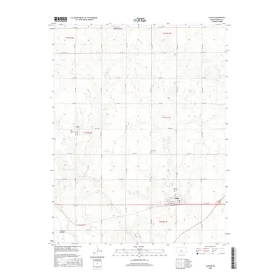
2015 Map of Claflin
USGS Topo · Published 2015About this map
Claflin stands as a central hub in this agricultural landscape of Barton County, where a rigid grid of rural roads like Ne 180 RD and Ne 90 Ave defines the modern land divisions. The survey documents several distinct community clusters, including Odin and Hitschmann, which serve as long-standing anchors for the surrounding farmsteads. Local genealogy is well-supported by the inclusion of several burial sites, such as Pleasant View Cem near the town center, Bloomingdale Cem, and Holy Family Cem located on the western edge of the quadrangle.
Find a feature on this map
38 named features on this map. Tap any name to fly to it.
Don’t see what you’re looking for? This feature index may not catch every label — zoom into the map to look around manually.
Map Details
Editions of this 2015 Claflin Map
This is the sole edition of this map. No revisions or reprints were ever made.
Other maps of this area

1891 · Great Bend
USGS Topo · 1:125,000

1893 · Great Bend
USGS Topo · 1:125,000

1894 · Ellsworth
USGS Topo · 1:125,000

1894 · Lyons
USGS Topo · 1:125,000

1896 · Russell
USGS Topo · 1:125,000

1955 · Great Bend
USGS Topo · 1:250,000

1956 · Ellinwood NE
USGS Topo · 1:24,000

1956 · Ellinwood NW
USGS Topo · 1:24,000

1957 · Great Bend
USGS Topo · 1:250,000

1958 · Great Bend
USGS Topo · 1:250,000