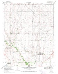
1969 Map of Claflin
USGS Topo · Published 1971About this map
The Kraft-Prusa Oil and Gas Field dominates the central landscape of Barton County in the late 1960s, with numerous oil wells scattered across the prairie. The town of Claflin serves as the primary hub, situated at the junction of the Missouri Pacific railroad. Further north and west, the smaller settlements of Odin and Hitschmann anchor rural communities, with the Holy Family Ch and its accompanying Holy Family Cem serving as local landmarks.
Find a feature on this map
26 named features on this map. Tap any name to fly to it.
Don’t see what you’re looking for? This feature index may not catch every label — zoom into the map to look around manually.
Map Details
Editions of this 1969 Claflin Map
This is the sole edition of this map. No revisions or reprints were ever made.
Other maps of this area

1891 · Great Bend
USGS Topo · 1:125,000

1893 · Great Bend
USGS Topo · 1:125,000

1894 · Ellsworth
USGS Topo · 1:125,000

1894 · Lyons
USGS Topo · 1:125,000

1896 · Russell
USGS Topo · 1:125,000

1955 · Great Bend
USGS Topo · 1:250,000

1956 · Ellinwood NE
USGS Topo · 1:24,000

1956 · Ellinwood NW
USGS Topo · 1:24,000

1957 · Great Bend
USGS Topo · 1:250,000

1958 · Great Bend
USGS Topo · 1:250,000