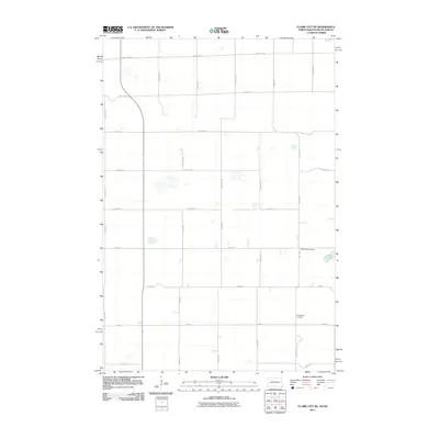
2011 Map of Claire City NE
USGS Topo · Published 2011About this map
Saint Pauls Cemetery and Ferkingstad Cemetery anchor the southern reaches of this rural landscape on the border of North and South Dakota. The terrain is defined by a rigid grid of section roads, including 155th Ave SE and 104th St, which trace the agricultural development of the region. A notable natural break in the geometric layout occurs near Indian Slough, where the hydrology of the plains disrupts the straight lines of the survey. The map records the persistence of local landmarks and historical burial sites in an area otherwise dominated by large-scale farming and arterial routes like County Rd 22. This survey illustrates how the systematic township-and-range division has structured the landscape, leaving small pockets for community heritage sites amidst the vast productive fields of the Heipa District.
Find a feature on this map
26 named features on this map. Tap any name to fly to it.
Don’t see what you’re looking for? This feature index may not catch every label — zoom into the map to look around manually.
Map Details
Editions of this 2011 Claire City NE Map
This is the sole edition of this map. No revisions or reprints were ever made.
Other maps of this area

1904 · Wahpeton
USGS Topo · 1:125,000

1907 · Wyndmere
USGS Topo · 1:125,000

1917 · New Effington
USGS Topo · 1:62,500

1953 · Milbank
USGS Topo · 1:250,000

1953 · Fargo
USGS Topo · 1:250,000

1956 · Fargo
USGS Topo · 1:250,000

1958 · Milbank
USGS Topo · 1:250,000

1964 · Hankinson
USGS Topo · 1:24,000
1964 · Lidgerwood
USGS Topo · 1:24,000
1964 · Swan Lake
USGS Topo · 1:24,000