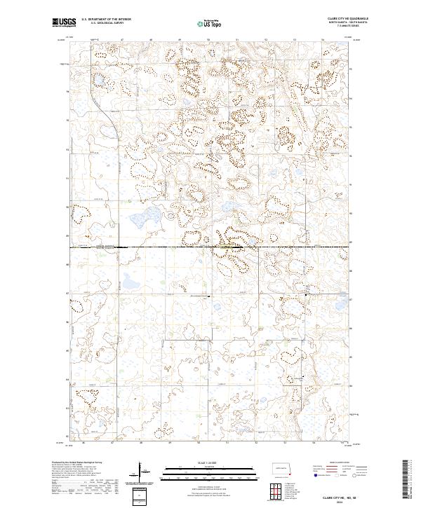
2024 Map of Claire City NE
USGS Topo · Published 2024About this map
Richland County Waterfowl Production Area and Roberts County Waterfowl Production Area dominate this prairie landscape along the North Dakota South Dakota border. The map illustrates a region defined by its wetland conservation and agricultural grid, where the transition between Richland and Roberts counties is marked by a network of sectional roads like 102nd St SE and 457th Ave. Several rural ecclesiastical sites serve as important landmarks for family historians, including Zion Lutheran Church Cem, Saint Paul's Cem, and Ferkingstad Cem. To the east, Indian Slough indicates the low-lying drainage patterns typical of this glacial till plain, while the dense concentration of designated waterfowl areas highlights the area's role in the regional ecology of the Northern Plains.
Find a feature on this map
43 named features on this map. Tap any name to fly to it.
Don’t see what you’re looking for? This feature index may not catch every label — zoom into the map to look around manually.
Map Details
Editions of this 2024 Claire City NE Map
This is the sole edition of this map. No revisions or reprints were ever made.
Other maps of this area

1904 · Wahpeton
USGS Topo · 1:125,000

1907 · Wyndmere
USGS Topo · 1:125,000

1917 · New Effington
USGS Topo · 1:62,500

1953 · Milbank
USGS Topo · 1:250,000

1953 · Fargo
USGS Topo · 1:250,000

1956 · Fargo
USGS Topo · 1:250,000

1958 · Milbank
USGS Topo · 1:250,000

1964 · Hankinson
USGS Topo · 1:24,000
1964 · Lidgerwood
USGS Topo · 1:24,000
1964 · Swan Lake
USGS Topo · 1:24,000