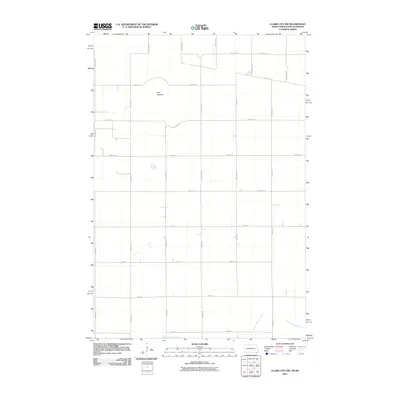
2011 Map of Claire City NW
USGS Topo · Published 2011About this map
The Little Minnesota River meanders across the southeast corner of this landscape, marking a significant hydrologic feature in a region defined by its wide agricultural sections. The northern portion of the map is dominated by the Park Lakebed, a terrain feature that suggests the area's post-glacial history and changing water levels over time. The land is organized by a strict rectilinear grid of rural roads, including County Rd 22 and County Rd 19, which facilitate movement across the border of North Dakota and South Dakota. This 2011 survey captures the area as a modern agricultural expanse, where small intermittent water bodies are scattered across the sections, reflecting the prairie pothole geography characteristic of this borderland district.
Find a feature on this map
26 named features on this map. Tap any name to fly to it.
Don’t see what you’re looking for? This feature index may not catch every label — zoom into the map to look around manually.
Map Details
Editions of this 2011 Claire City NW Map
This is the sole edition of this map. No revisions or reprints were ever made.
Other maps of this area

1907 · Wyndmere
USGS Topo · 1:125,000

1953 · Milbank
USGS Topo · 1:250,000

1953 · Fargo
USGS Topo · 1:250,000

1956 · Fargo
USGS Topo · 1:250,000

1958 · Milbank
USGS Topo · 1:250,000

1958 · Veblen
USGS Topo · 1:24,000

1958 · Veblen NE
USGS Topo · 1:24,000

1958 · Geneseo
USGS Topo · 1:24,000
1964 · Lidgerwood
USGS Topo · 1:24,000
1964 · Swan Lake
USGS Topo · 1:24,000