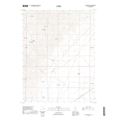
2018 Map of Clan Alpine Ranch
USGS Topo · Published 2018About this map
Clan Alpine Ranch serves as a lone human waypoint in this high-desert landscape of central Nevada. The terrain is dominated by the steep, drainage-cut slopes of the Clan Alpine Mountains, where numerous natural water sources like Deep Canyon Spring, Willow Spring, and Box Spring were essential for ranching and travel through this arid region. The map reveals a complex network of canyons, including North Fork War Canyon and Starr Canyon, which drop away from high points like Shaley Peak. To the east, the mountains give way to the broad Edwards Creek Valley, where seasonal watercourses like Cherry Cr and Cedar Cr terminate. The presence of the Old Overland Rd in the southeastern corner highlights the area's history as a transit corridor across the Great Basin.
Find a feature on this map
25 named features on this map. Tap any name to fly to it.
Don’t see what you’re looking for? This feature index may not catch every label — zoom into the map to look around manually.
Map Details
Editions of this 2018 Clan Alpine Ranch Map
This is the sole edition of this map. No revisions or reprints were ever made.
Other maps of this area

1955 · Millett
USGS Topo · 1:250,000

1959 · Millett
USGS Topo · 1:250,000

1966 · Clan Alpine Ranch
USGS Topo · 1:62,500

1966 · Edwards Creek Valley
USGS Topo · 1:62,500

1969 · Camp Creek Canyon
USGS Topo · 1:24,000

1969 · Cold Springs
USGS Topo · 1:24,000

1969 · Basque Summit
USGS Topo · 1:24,000

1983 · Edwards Creek Valley
USGS Topo · 1:100,000

1985 · Smith Creek Valley
USGS Topo · 1:100,000

1990 · Byers Ranch
USGS Topo · 1:24,000