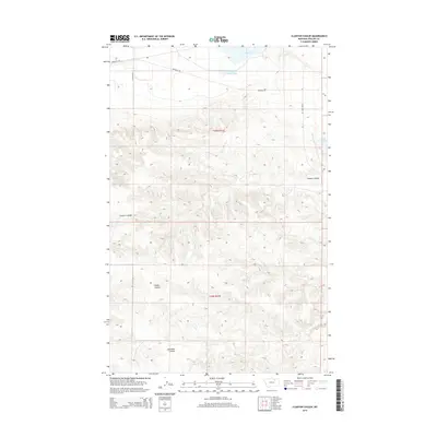
2014 Map of Clanton Coulee
USGS Topo · Published 2014About this map
Clanton Coulee and its neighboring drainages define this stretch of Phillips County, where the Montana landscape is carved by seasonal watercourses and remote ranching access. The terrain is characterized by complex contouring that funnels toward LeNoir Coulee and Gonzales Coulee, illustrating the natural hydrological patterns of the northern plains. Water management in this arid region is central to the land's utility, marked by features such as Goose Island Pond, the Drumbo Unit, and the LeNoir Reservoir. Surface transportation is limited to established rural routes including Bowdoin Rd and E Strater Rd, which follow the section lines and natural topography to connect isolated points in the t30n r31e and t29n r31e townships.
Find a feature on this map
11 named features on this map. Tap any name to fly to it.
Don’t see what you’re looking for? This feature index may not catch every label — zoom into the map to look around manually.
Map Details
Editions of this 2014 Clanton Coulee Map
This is the sole edition of this map. No revisions or reprints were ever made.
Other maps of this area

1905 · Bowdoin
USGS Topo · 1:62,500

1954 · Glasgow
USGS Topo · 1:250,000

1957 · Glasgow
USGS Topo · 1:250,000

1958 · Glasgow
USGS Topo · 1:250,000
1968 · Malta NE
USGS Topo · 1:24,000

1968 · Malta East
USGS Topo · 1:24,000

1984 · Clanton Coulee
USGS Topo · 1:24,000

1984 · Pinks
USGS Topo · 1:24,000
1984 · Bowdoin
USGS Topo · 1:24,000
1984 · Lake Bowdoin
USGS Topo · 1:24,000