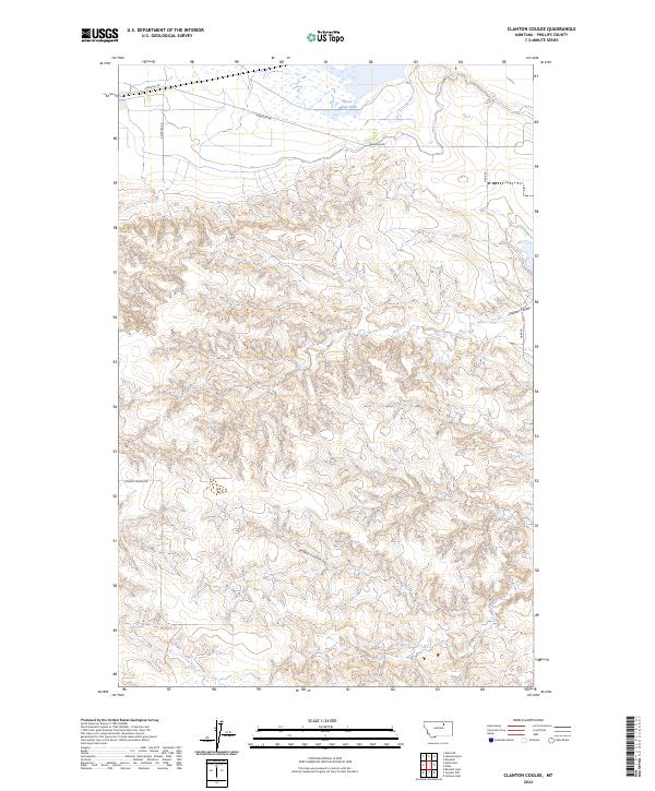
2024 Map of Clanton Coulee
USGS Topo · Published 2024About this map
The Bowdoin National Wildlife Refuge dominates the northern edge of this landscape, where the northern plains give way to the wetlands of Goose Island Pond. This area of Phillips County is defined by its drainage patterns, with the deep carvings of Clanton Coulee and LeNoir Coulee illustrating the persistent water-carved topography of the region. The map reveals a sparse infrastructure typical of this part of Montana, organized primarily around the Public Land Survey System grids of t30n r31e, t30n r32e, and t29n r31e. Modern access is maintained through a network of local routes including Bowdoin Rd and S Black Coulee Rd, which navigate the complex breaks and coulees. This survey provides a precise look at the intersection of protected waterfowl habitat and the open rangeland of the American West.
Find a feature on this map
11 named features on this map. Tap any name to fly to it.
Don’t see what you’re looking for? This feature index may not catch every label — zoom into the map to look around manually.
Map Details
Editions of this 2024 Clanton Coulee Map
This is the sole edition of this map. No revisions or reprints were ever made.
Other maps of this area

1905 · Bowdoin
USGS Topo · 1:62,500

1954 · Glasgow
USGS Topo · 1:250,000

1957 · Glasgow
USGS Topo · 1:250,000

1958 · Glasgow
USGS Topo · 1:250,000
1968 · Malta NE
USGS Topo · 1:24,000

1968 · Malta East
USGS Topo · 1:24,000

1984 · Clanton Coulee
USGS Topo · 1:24,000

1984 · Pinks
USGS Topo · 1:24,000
1984 · Bowdoin
USGS Topo · 1:24,000
1984 · Lake Bowdoin
USGS Topo · 1:24,000