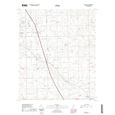
2020 Map of Clanton East
USGS Topo · Published 2020About this map
Chestnut Creek and its various forks, including the South Prong, wind through this central Alabama landscape, defining the rural character of the region. The eastern outskirts of Clanton are visible in the northwest, where the Chilton County Airport and Chilton Memorial Gardens mark the transition from the town center to the countryside. The map reveals a dense network of country roads connecting small settlements like Falakto, Cooper, and Verbena, reflecting a persistent pattern of rural habitation.
Find a feature on this map
152 named features on this map. Tap any name to fly to it.
Don’t see what you’re looking for? This feature index may not catch every label — zoom into the map to look around manually.
Map Details
Editions of this 2020 Clanton East Map
This is the sole edition of this map. No revisions or reprints were ever made.
Other maps of this area

1891 · Clanton
USGS Topo · 1:125,000

1901 · Wetumpka
USGS Topo · 1:125,000

1903 · Wetumpka
USGS Topo · 1:125,000

1953 · Montgomery
USGS Topo · 1:250,000

1956 · Montgomery
USGS Topo · 1:250,000

1957 · Montgomery
USGS Topo · 1:250,000

1959 · Billingsley
USGS Topo · 1:62,500

1959 · Elmore
USGS Topo · 1:62,500
1971 · Mitchell Dam NW
USGS Topo · 1:24,000
1971 · Mitchell Dam
USGS Topo · 1:24,000